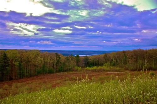
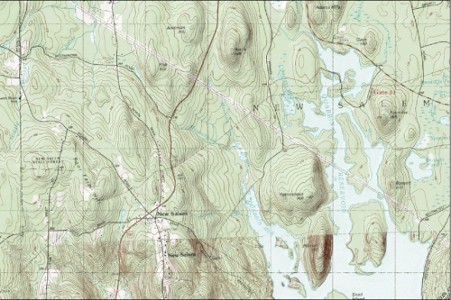
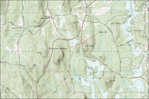
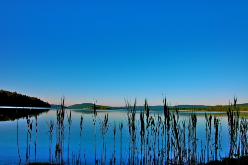
The Quabbin Reservoir encompasses 38.6 square miles of space, holds 412.24 billion gallons of water, spans approximately 18 miles at its greatest length, and has an average depth of 51 feet with a max depth of 150 feet. It is fed by a sizeable number of small streams from the neighboring high grounds but yields its greatest flow from the 3 branches of the Swift River. It has 3,500 acres of land divided prejudicially among 60 islands, and Quabbin boasts an 11,000-acre cape as well as 118 miles of shoreline, 181 miles including all the islands.
The 20 major islands are Bassett, Moore, Snell, Hamilton, Nelson, Mt Russ, Mt L, Leveau, Mt Zion, Carrick, Stevens, Southworth, Chapman, Curtis Hill, Parker Hill, Den Hill, Walker Hill, Mt Pomeroy, Mt Lizzie, and Little Quabbin Hill. There are also approximately 40 other islands with either no name to speak of or names that few have heard of. All of them, plus Prescott Peninsula, are off-limits to public traffic.
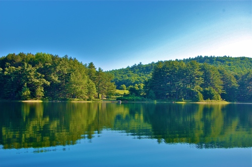
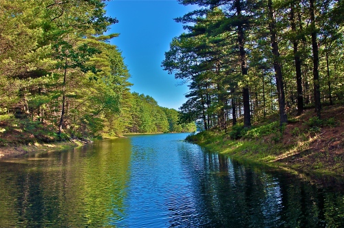
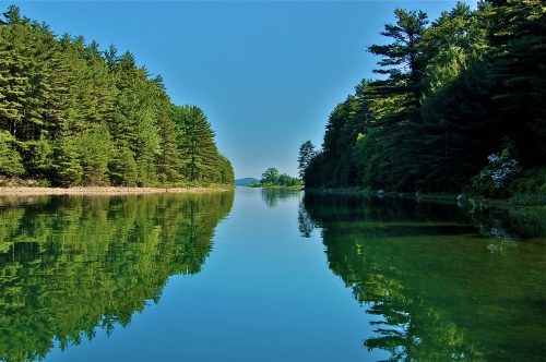
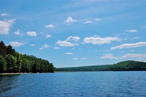
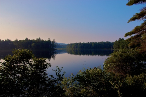
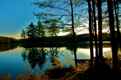
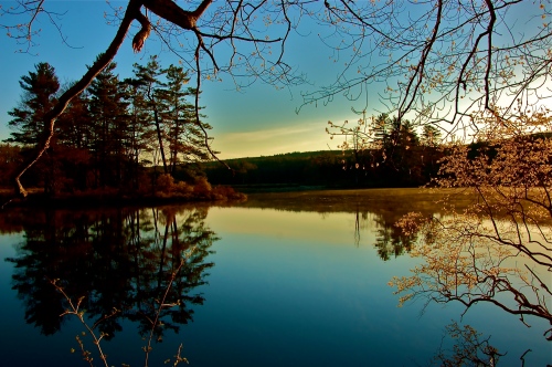
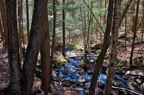
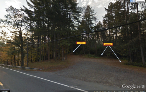
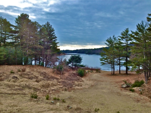
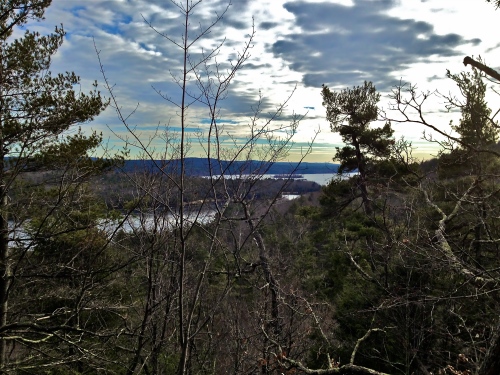
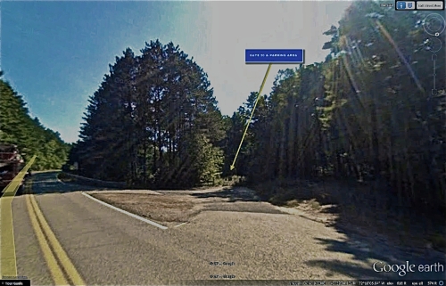
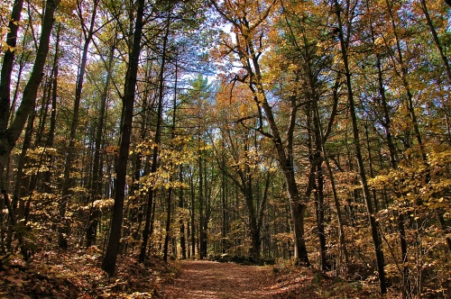
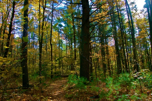
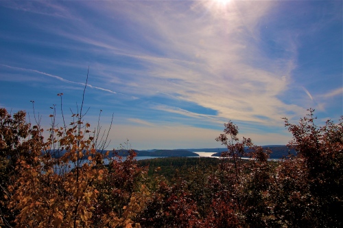
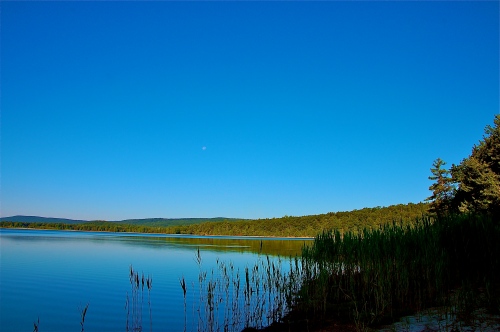
When launching from Gate 31, just over half of your seaborne travel is bordered on the west by the Peninsula, while the remainder is covered by the New Salem Watershed. With all these apparent constraints, it may seem as though a day on the water is better spent fishing than admiring intrinsic magnificence. However, even the most passionate fishermen among us who have spent a minute of their time on these waters will acknowledge that the landscape is so dynamic that every new spot –every turn around a corner- flushes individual bearing by creating a feeling anew of where you are. That is to say that even though you’re in the same waters, every time you stop the boat, it feels like you’ve landed in a brand new world; a world with unambiguous magnificence, but exceedingly diverse settings.
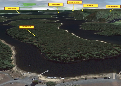
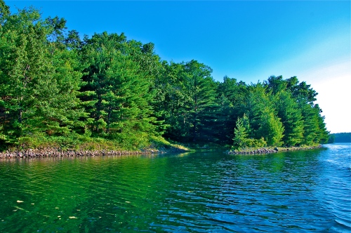
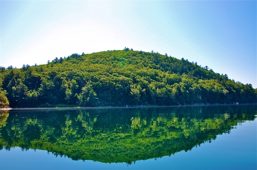
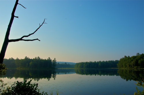
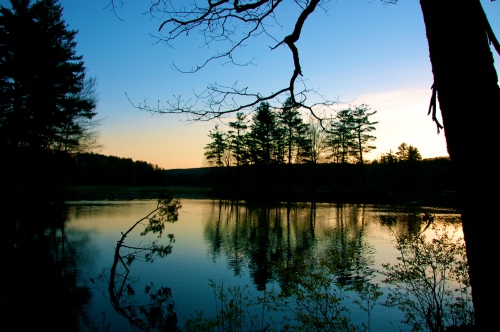
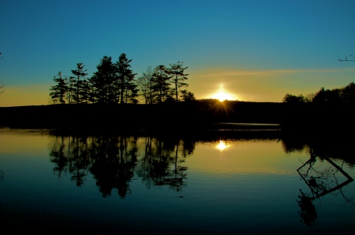
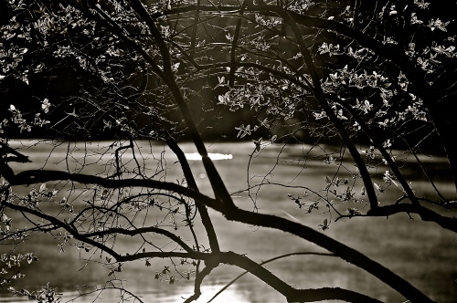
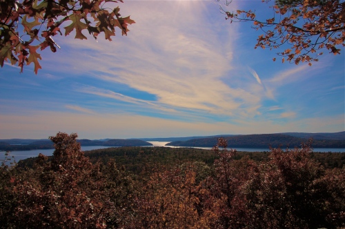
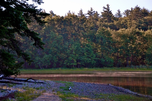
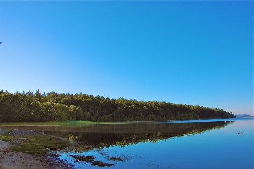
From the north, originating in Fishing Area 2, you are first faced with a diversion generated by Bassett Island, which will impel you to go left or right. Either direction is equally gorgeous, but the south (left) course takes you on a more direct route to the open water whereas the north (right) course is for those who have more time to meander around the upper lagoons. Every time I have launched, I have always gone north on the way out, but the inbound route varies depending on need, at least for me. I particularly enjoy departing to the north because most people will do so and then curve south to hit the open water. However, once around the horn on Bassett Island, I enjoy snaking back west and north through the various crevices the upper Quabbin has to offer. In one instance, around a short series of turns, there is one island that shines like an angel walking on water when the sun strikes it at sunrise. New Salem’s Watershed is the milieu, which is fronted by beautiful, ominous pines tiered higher with the backset elevation, and the forefront water itself looks like glass and blurs the peaceful reflection of the trees when there’s a placid wind.
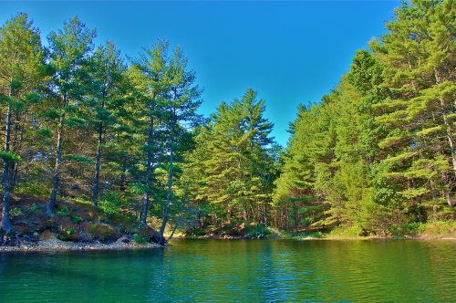
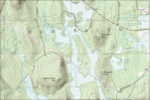
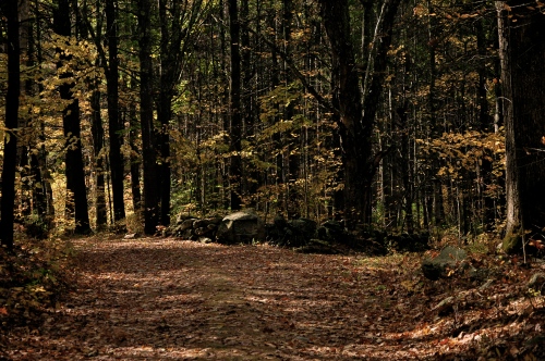
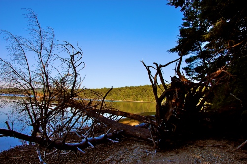
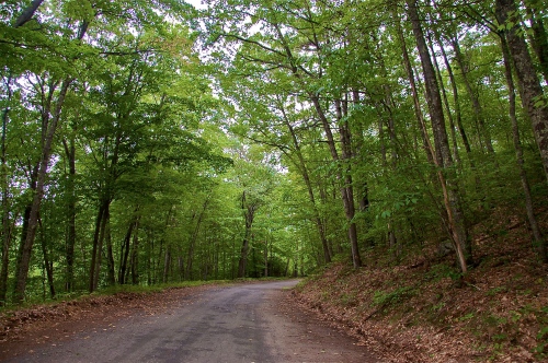
When you depart these winding water crevices and head south, you find yourself in the strait flanked by Bassett Island and the low ground at the base of [North] Rattlesnake Hill. One old road in this particular spot (as well as dozens more throughout) enters the water, tapering off under the scourge of the deluge as a reminder of a time and a place once inhabited and alive with traffic, commerce, and population. It is through this strait that you can also experience Mountain Laurels bursting away from the coast in an overtly outcropped posture over the water. One such place is so alive with this delicate blossom that they appear to own the tiny peninsula upon which they rest.
Further south, as you now approach the imposing [North] Rattlesnake Hill summit, you will encounter the Achilles heel of the Quabbin Valley; that one imperfection that plagues yet every living and non-living entity on the planet –an ugly side! Throughout the Quabbin there is a panduit where high-tension wires run. This wedge is driven from the southwest Vermont border with New York, to southeast near Millbury, Massachusetts, just south a slightly east of Worcester. It affects Quabbin views only momentarily as you pass under it between the upper northwest to the upper eastern portions. The best advice I can offer is to ignore it like every other nuisance until it goes away or until you have moved past it. As you pass under it on boat, you can look down the chute toward the rest of Quabbin’s ostentatious exquisiteness.
Now that we’ve passed that unsightliness, look right (west) and you will be viewing the steep slopes of [North] Rattlesnake Hill. It’s tremendously difficult to see through any of the thick, Quabbin vegetation no matter where you are, but usually there are ruptures in the bulk that allow enticing peeks into the heart of the Quabbin loin.
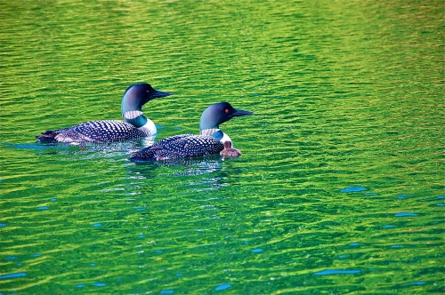
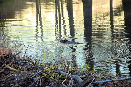
Go further south and look left (east), you’ll see Moore Island. Look north, Gays Hill. Look right, (west) Pittman Hill. Wildlife abounds yet again in Quabbin. Bald eagles, loons, Mallard ducks, even a father-son team claiming to have seen a bobcat on the shore, and so many more –all in one day! As you circle the horn on Pittman Hill and loop back to the north, you can see floating refuges for the loons, placed by the DCR that I have warmly come to refer to as loony bins. When you power the boat off, you can hear their cries, as well as the lamentation from local coyotes on the mainland among other songs of the indigenous inhabitants. On one occasion there was one such loon family that consisted of a male and female. Initially I was perplexed as to why it was they were lingering as I circled in the boat, when normally they flee at first rudder! Soon it came to pass that I witnessed their raison d’être: they were harboring a loon-ling! A baby loon was in their hospice and as it was incapable of flight or evasion, mom & dad remained. Before leaving, I was able to snap an epic photo of mama-loon barking at me from a frontal angle.
Following the Pittman Hill shoreline will deliver you on a western bearing, with Snell Island now to your left, reinforced by a backdrop view of Hamilton Island just behind it. Moving north, now on the west side of Pittman Hill, there is a series of small islands through which you may twist and turn but be careful of shallow water. Even when at capacity, the Quabbin has numerous shallow locations that can cause damage to your motor. With all the spectacular scenes, it’s easy to become distracted. On one occasion I nearly ran over a giant boulder while observing a bald eagle in the vicinity of Pittman Hill.
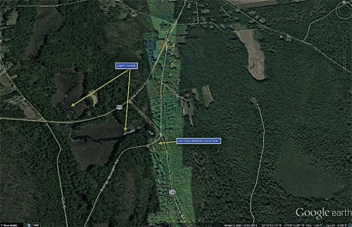
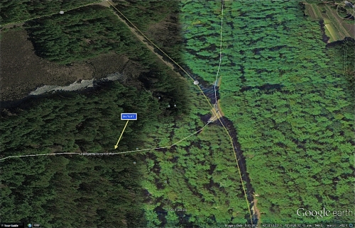
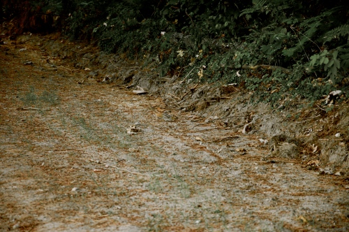
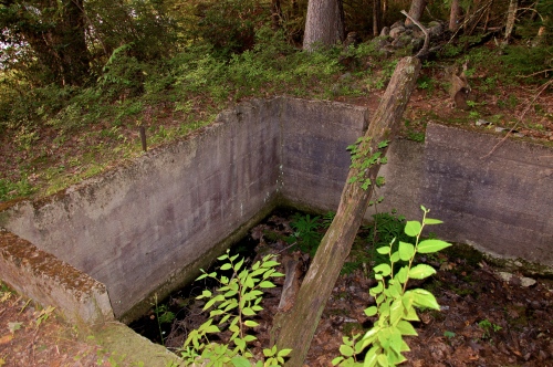
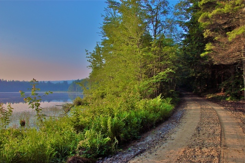
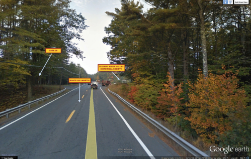
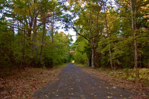
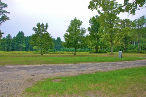
Heading further north in this bay, you begin to see Rattlesnake Hill and Pittman Hill more as a combined peninsula, rather than a part of the watershed in New Salem. With both hills now to the east (right), you drift north a little further only to have what appears to be a ley on a hill staring back at you. Closer review reveals another sunken road to its side. One key indicator that you are bounding upon an old, sunken road is to see a dead tree being used as a blockade along the end of it. Such is also true at this location. Peering into the depths of the road under the canopy of trees, you notice the road going up a slight incline. If you were to go to Gate 29 in New Salem, you could follow the paved road all the way to the end, at this particular spot and see the inverse view. More of the land-based detail will be covered in my blog: Gate 29, which will have a number of very unique images of significant and baffling interest.
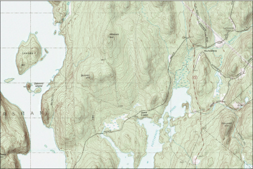
Finally, as you maneuver south around all the smaller islands and once again pass Snell & Hamilton Islands, you come upon Nelson Island, north and west of which is a large inlet bay; large enough to house its own, tiny island.
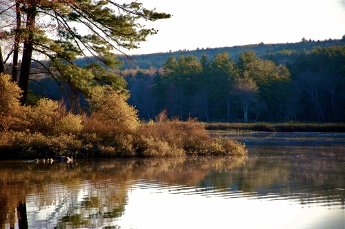
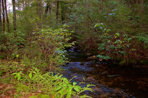
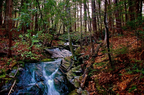
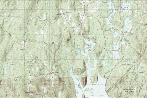
Beyond that is the grand finale of the New Salem watershed, marked by the mouth to Hop Brook. Several bays line this jagged coast, generating unique viewing terrain in every fissure. The mouth of Hop Brook itself is equally impressive, even when not full.
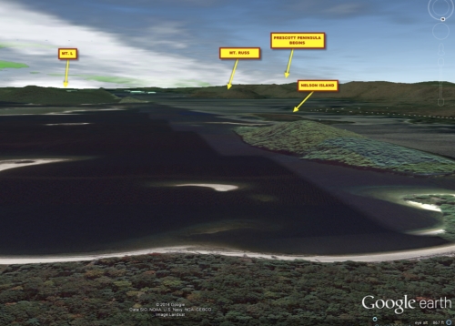
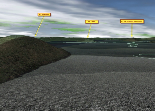
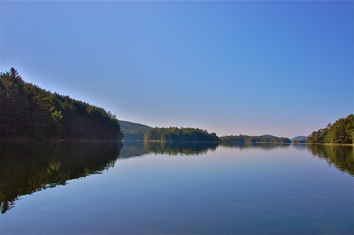
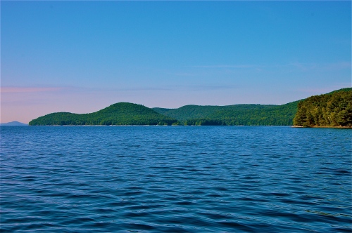
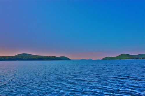
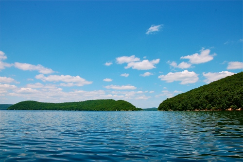
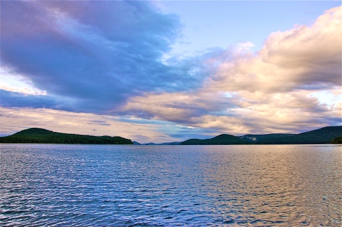
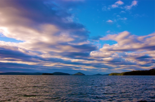
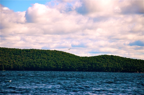
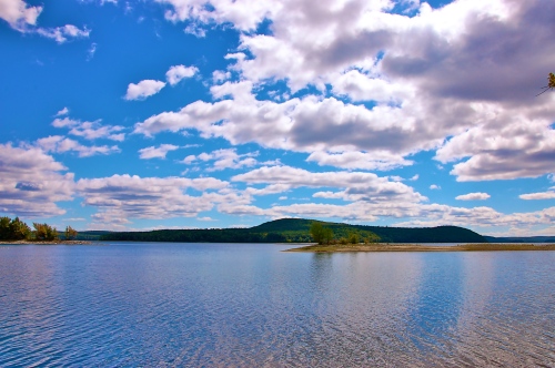
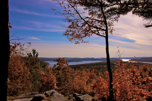
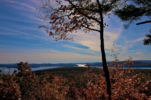
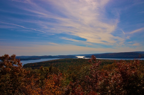
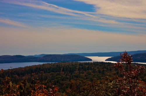
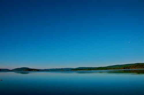
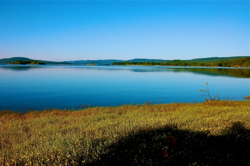
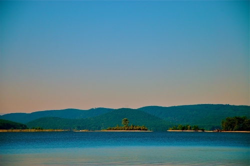
Looking south, you will now, at last, witness the open seas on Quabbin Waters. An unobstructed, uncorrupted, an unmoved piece of the planet that you can see all at once. The two enormous hulks sitting on the edges of your panorama are Mt L (left) and Mt Russ (right). Both appear to bear mirror inversions of one another with their lower hills facing the canal between them, while higher ground rests on the outer edges. Although this mainly sums up the landscape of Mt Russ, Mt L has vastly greater detail; nor should this limited description of Mt Russ be used to moderate its awesome presence and majesty. The channel serves as a gateway to the largest, flattest part of the waters, giving you a peek of untouchable lands in the restricted south waters on the horizon. However, before you’re tempted to crank the motor through the wide channel, I’d recommend a rightward course to Mt Russ first.
Without having done it myself, I might have never known that there were tiny avenues to the west of Mt Russ, separating the gorgeous island from Prescott Peninsula. Mt Russ itself really consists of 3 islands. One is so small that you could throw a rock right over it. Another is so large that it should be an island of its own name. The navigable waters between them all are beautiful in and of themselves, but the back view of where Mt Russ meets Prescott Peninsula is always peacefully trepidatious.
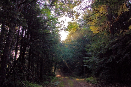
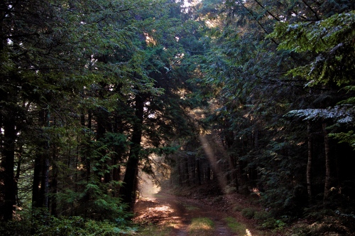
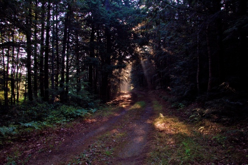
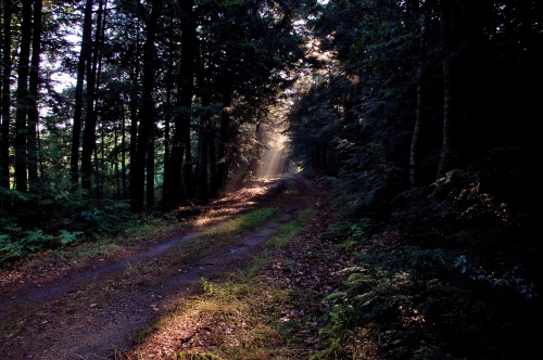
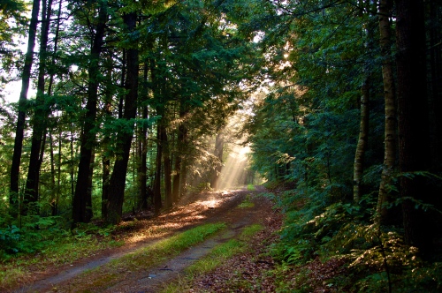
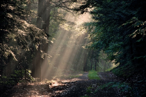
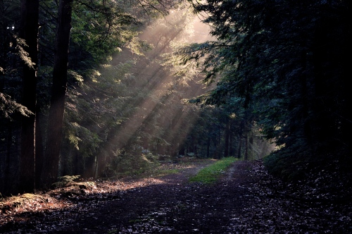
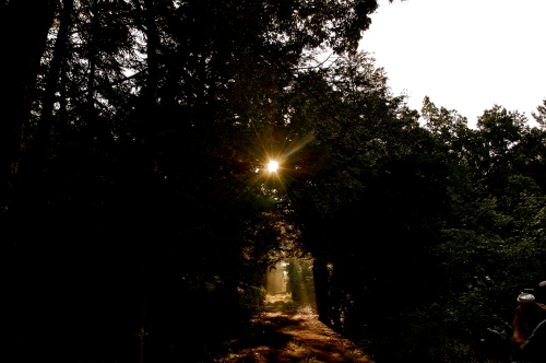
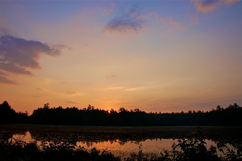
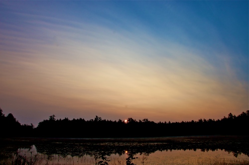
On most mornings in the summer, you can see this enchanting part of the waters at sunrise. Thick fog rises from the chasms of trees, ridges, and valleys to form pillars of smoke, reminiscent of tribal smoke-signals, as if to serve as a reminder of after whom the region is named.
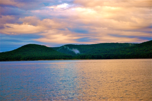
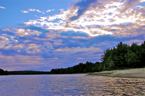
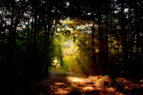
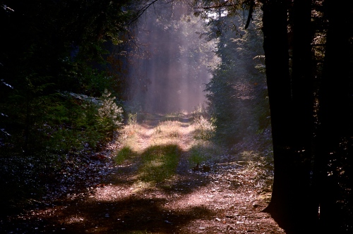
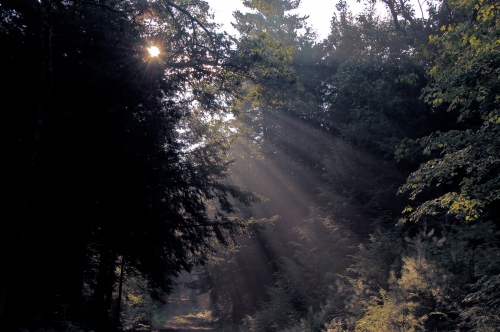
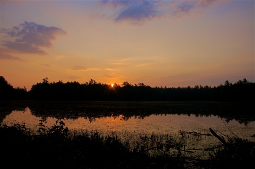
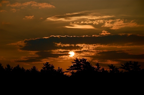
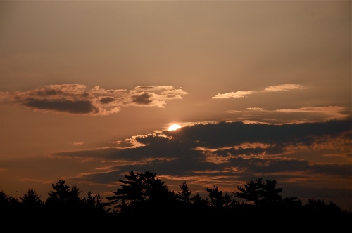
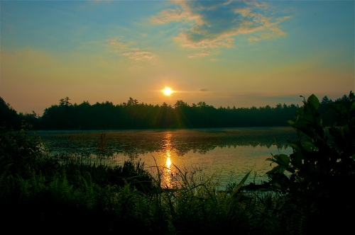
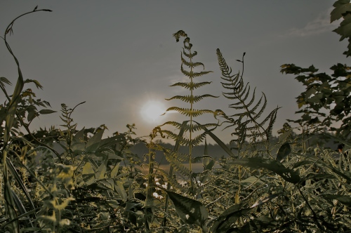
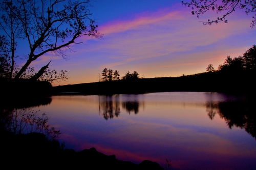
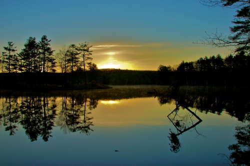
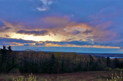
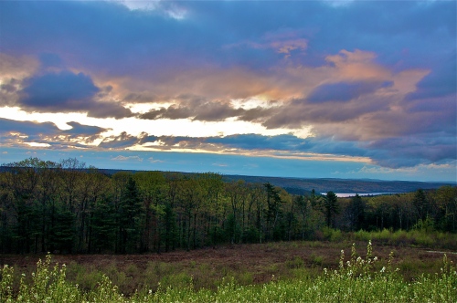
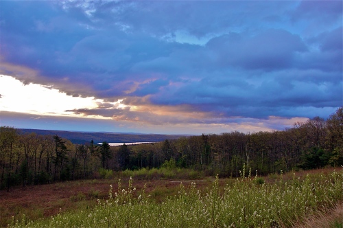
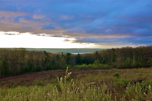
Sunrise creates countless wonders on the waters of Quabbin. Blue clouds topped with searing light from a hidden sunrise, water and horizons turn black while the ambient light becomes a penetrating bronze. Portions of light shine on select slices of land like a heavenly glow on the purest of souls. Rays from the sun burst through cloud segment in a spectacular show of light seen from any range. Some light is so bright and so distorted by the curvature of the clouds that it actually makes the clouds look blurry!
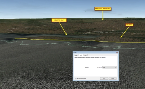
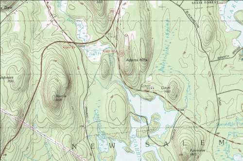
Looking at Prescott Peninsula on a map, it can be seen as a microcosm of Italy. It’s shaped almost like a boot with a detached heel named Little Quabbin Hill Island. Toward the north end of Prescott, on the eastern side, there is a tumor of land that could otherwise resemble a holster on the back of someone’s leg, thus earning it the nickname, Holster. I mention this only for reference as you navigate this blog and the waters, should you decide to take the adventure for yourself.
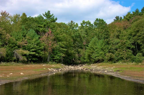
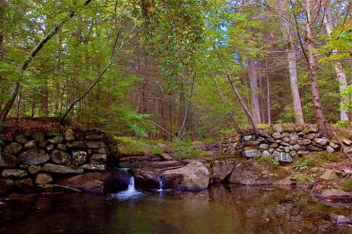
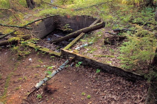
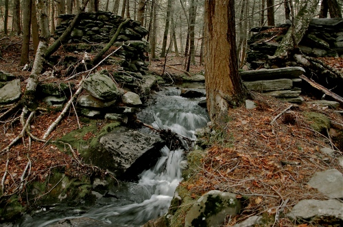
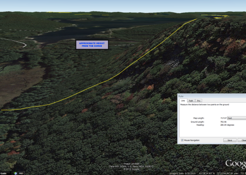
For instance, just north of where Holster begins, you can see a sharp incline if you peer deep beyond the veil of trees, one of the sharpest along the peninsula’s east coast. Just south of Holster, tucked deep in Holster Bay, you can find the mouth to Egypt Brook, marked by an old utility line left behind after the flooding, I presume, based on the antiquated configuration of the runners at the top. Coming out from Holster Bay back into the waters, you find one of the most prominent sunken roads in all of the Quabbin. This gravel road is, as most are, blocked by a fallen tree. However what makes this road so special is the fact that, when the water is low, you can see its beginning on land and actually follow it into the water not only by the smooth, improved feature associated with roads, but also in the flush lining of the road in fieldstone. It has a sharp descent off of its side that, according to contemporary standards, would be unfit for travel. On a modern road you would most certainly have a guardrail of some sort to protect against this dangerous drop-off. The road continues south, out into the water and you can actually see the fork left that loops back around the base of that perilous drop-off.
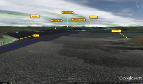
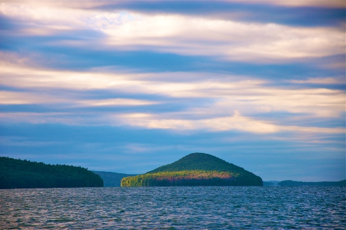
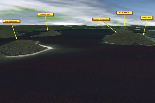
Hugging the coast along Holster the whole way will keep you in New Salem waters, otherwise you’ll end up in Petersham. To the southeast of Holster are two islands: Curtis Hill & Mt Pomeroy, the latter being home to the highest point above sea level on any island in the Quabbin. The Southeast corner of Mt Pomeroy (which is inaccessible) reaches 935 feet above sea level and drops to 450-500 feet along its shore, providing quite a dramatic and steep slope. Approaching Mt Pomeroy, you will see a sudden rise out of the water of towering trees along the shore, which is also specific to this magical isle as most places at least have beaches with sand leading to a gradual incline. Mt Pomeroy, however, with its standoffish posture, essentially creates an uninviting and hostile stance as its shore stands poised on alert to stop intruders. Ironically, its unique landscape also causes it to be one of the most alluring and sought after gems among all the islands. But don’t be too quick to see it in its entirety! Mt Pomeroy marks the southern limit of the waters. You may travel a little further south along its west coast than on its east, but off-limits nonetheless!
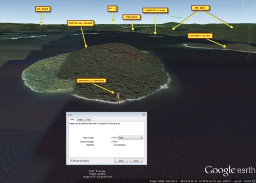
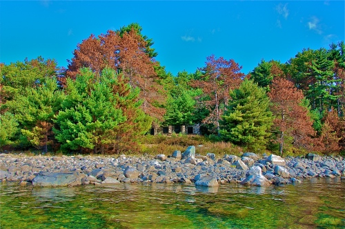
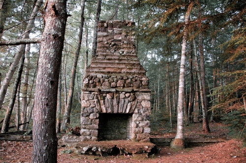
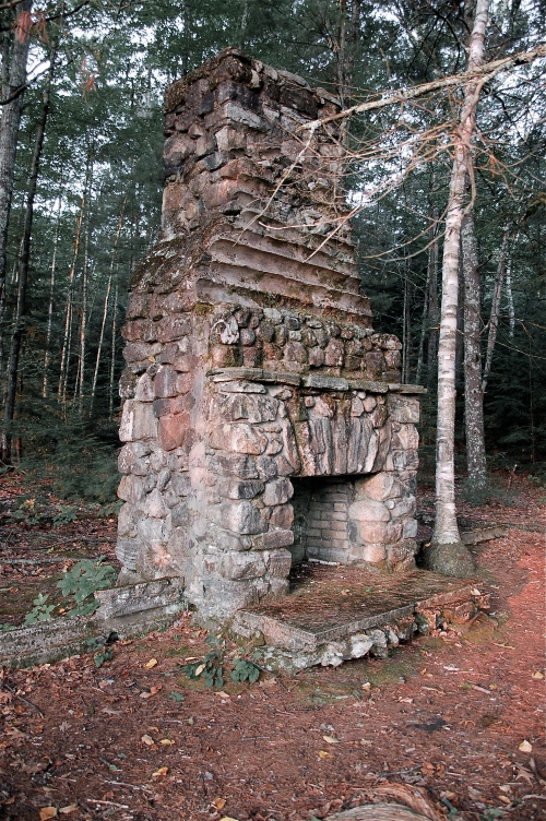
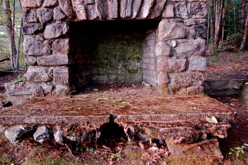
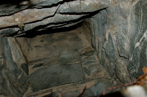
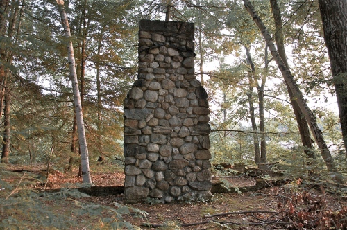
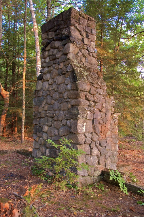
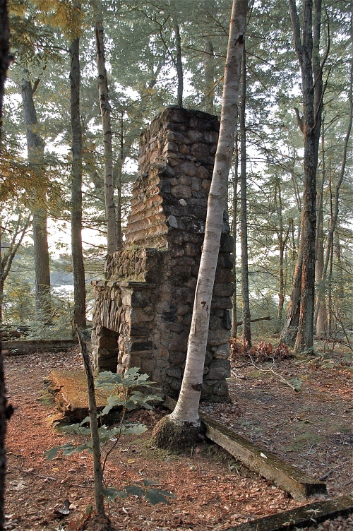
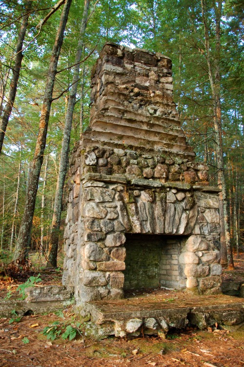
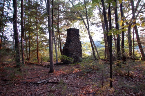
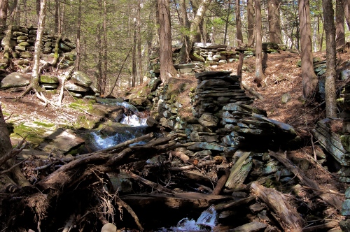
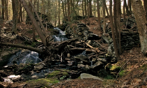
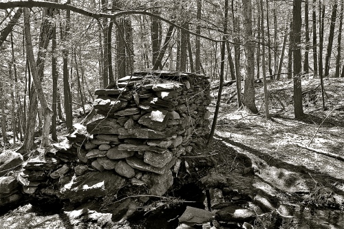
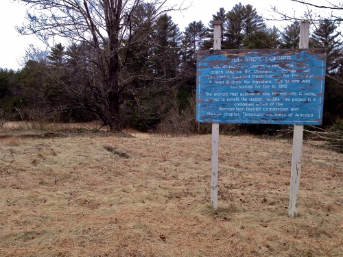
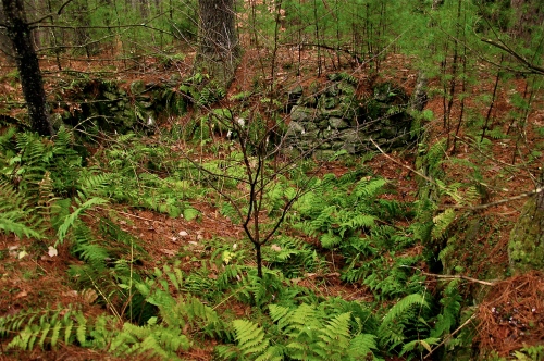
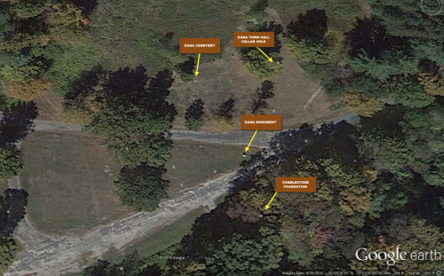
Therefore, we must now head north and begin our return. First stop: Curtis Hill; that hill just north of Mt Pomeroy. Why would we stop here, you ask? Curtis Hill holds in its possession a fabled relic. Curtis Hill is the ONLY place in the entire Quabbin that is known to have any structural remnant of the pre-flooding era (I say “known to have” because I still do not know if that utility pole is from pre-flooding, I only assume it is because of its architectural design. I say, “structural remnant” because there are other remnants that you’ll read about later, but none that are actual building still standing).
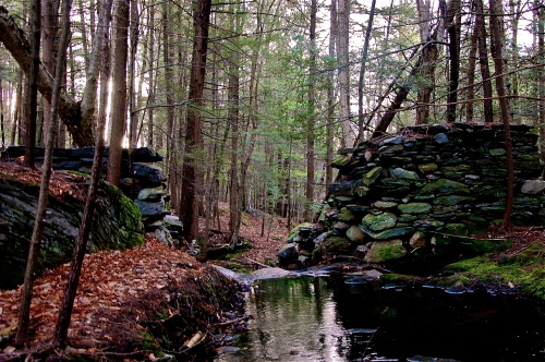
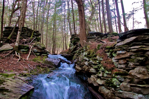
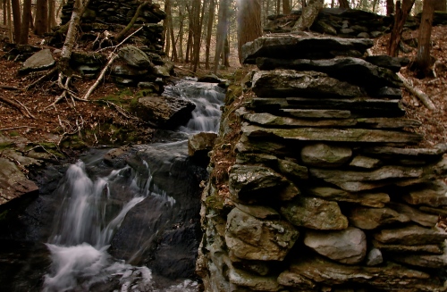
This sole vestige of tangible history manifests itself in the form of a golf course clubhouse called, Dugmar Clubhouse. I’ll let you do all the Googling you feel compelled to do but, suffice it to say, this clubhouse was built by two crooked entrepreneurs from the Springfield area when they found out this region would be flooded, in order to capitalize on its value and earn a return on their investment; which they did in exponential fashion.
The clubhouse still stands because it met the criteria for buildings and structures that did not need to be torn down: it was not made of wood and was made of nothing but stone. It can be seen from the southeast corner of Curtis Hill and, as big as it is; as ornately endowed as it is in contrast to its surroundings, you would probably never see it unless you were looking for it.
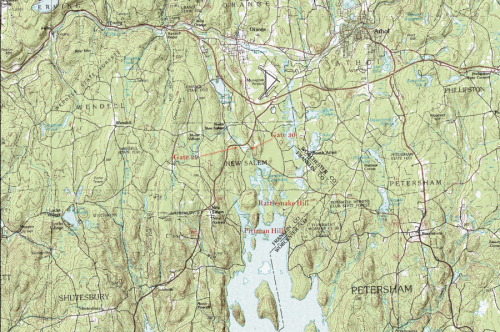
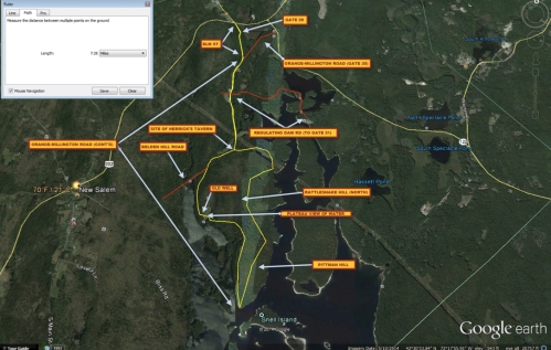
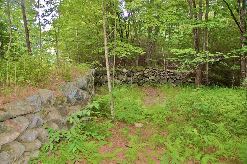
From the clubhouse you can look southeast and see Baffle Dam. Going past Parker Hill on its south side and then east to the dam will, more or less, run you long the Southern Limit line. It’s here that you can see MWRA (Massachusetts Water Resource Authority) buildings and the dam used to operate the actual Aqueduct that sends all of this water to the supported communities in Boston, and several other municipalities east as well as west. The Baffle Dam conjoins Walker Hill Island to the largest island in the Quabbin: Mt Zion.
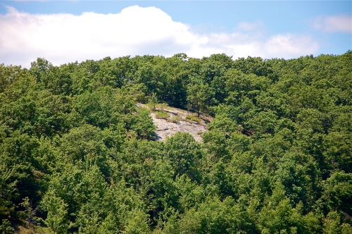
Mt Zion, like Prescott Peninsula, has steep slopes along its shores, but Mt Zion is significantly rockier than Prescott along its edge, and therefore this bald veneer gives the impression of a more dramatic cliff.
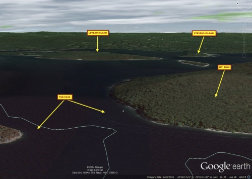
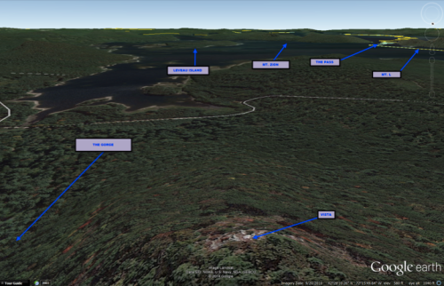
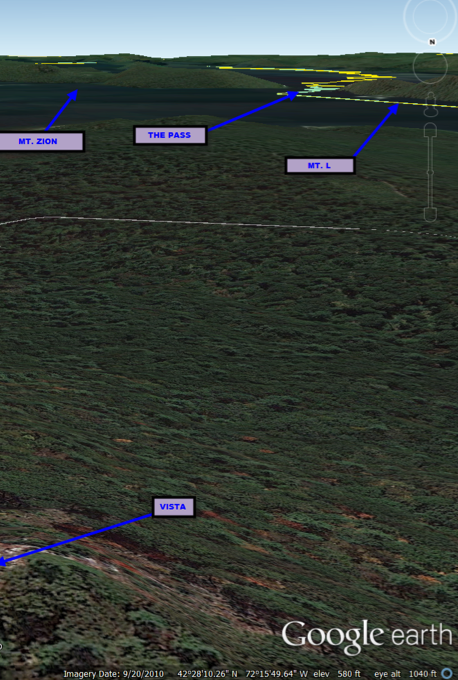
The majority of Mt Zion falls comfortably within the limits of Petersham, but the northern tip hugs the border with New Salem once again. The channel between Mt Zion and Mt L, to its north, is referred to as The Pass, and is also where the Petersham-New Salem line crosses. Wrapping around the north tip of Mt Zion, you can look left to Mt L and see it cleansed with green life throughout. There is one section that is almost completely bare on its northeastern slope. A patch of shaved fieldstone that offers a look at the innards of Mt L; a view of the underbelly of the natural forestation.
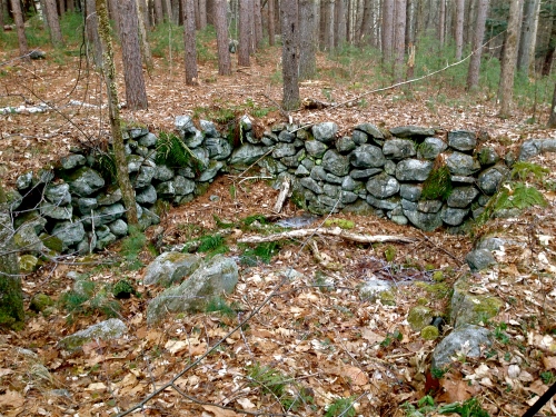
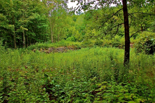
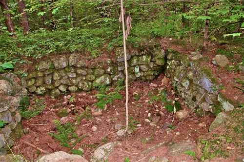
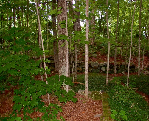
Shooting around the north side of Mt Zion reveals old property boundaries in typical, New England Fieldstone walls that are, yet again, partially submerged as they cross into the idyllic abyss. I even caught a turtle once, sunbathing on one of the rocks jetting out of the water.
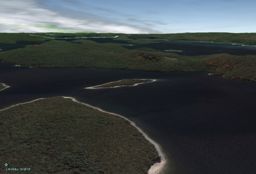
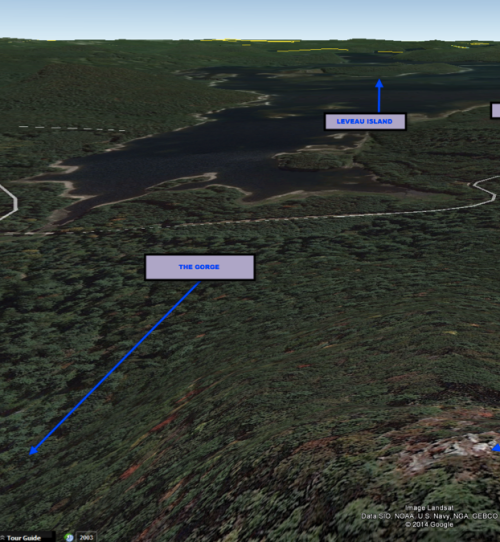
Continuing your stroll, now around the east side of Mt Zion, you’ll see Leveau Island to your left. If you continue south, you would head toward Gate 43: Fishing Area 3 and Pottapaug Pond, which would require a lot more weaving in and around small islands. More of this will be covered in Gate 43: Fishing Area 3.
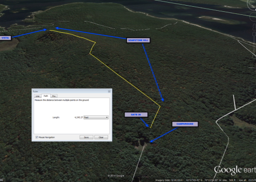
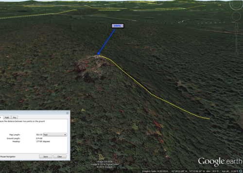
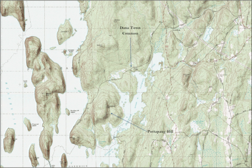
Turning north from Mt Zion and Leveau Island, however, will present a view from the water of the unadulterated best inborn outlook in the Quabbin: Soapstone Hill. The blog I write on this spot will not be long, but the content itself will be rich. Although Enfield Tower allows greater distances to be viewed, no sight is more beautiful in the entire Quabbin Reservoir than that which you see from the plateau of Soapstone Hill, located in North Dana.
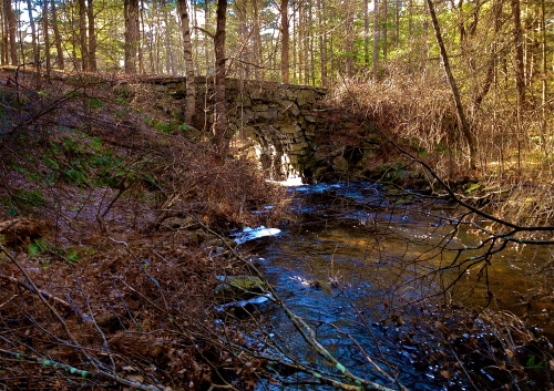
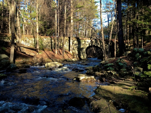
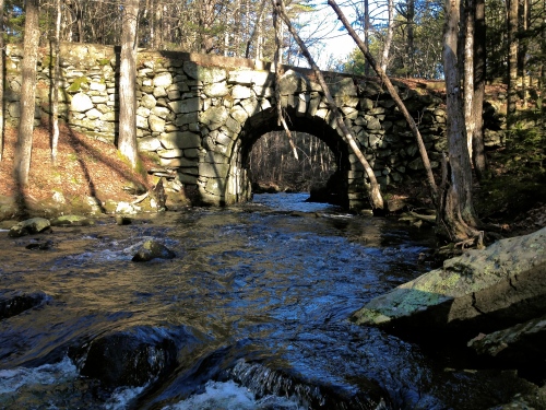
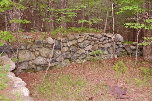
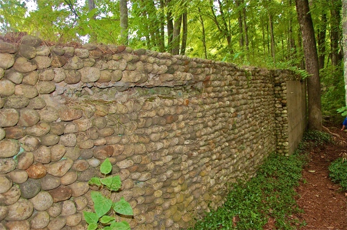
One last point I’ll discuss from Gate 31’s launch is the stone wall at the base of Soapstone Hill. It’s much easier to get to via Gate 37, and will be discussed there as well, but the view of it from the water is much more surreal as it’s a frontal shot, rather than an above or down-view. It serves now as a buffer wall for the water, but was once part of a regularly traveled bridge in Dana.
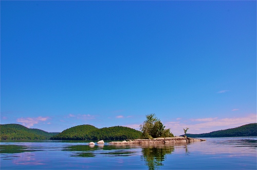
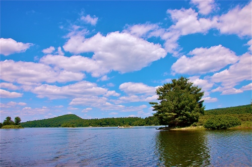
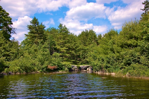
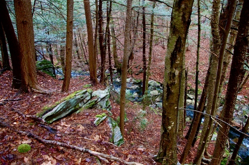
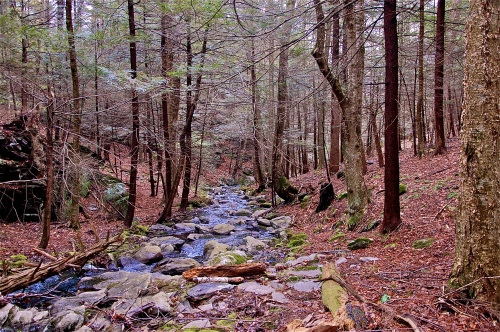
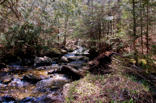
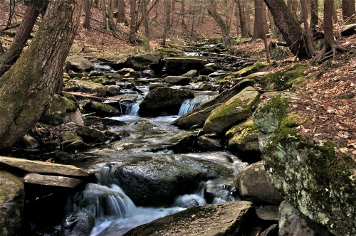
Traversing the waters of Quabbin is perpetually filled with surprises and tantalizing aesthetic wonders. Tiny inlet bays the size of a 2-car driveway (and structured much the same as one, too), open straits not much wider than your boat but over 12-feet deep, separating mainland from island, disparaging sandbars and nameless islands that shed greater beauty than an entire orchard, linear features that could be a fallen tree or a cellar wall under the mud, and so much more. These are the treasures of the Quabbin waters. These are just a few of the countless reasons why one would want to spend a day on the open, vivacious waters of the Quabbin Reservoir.
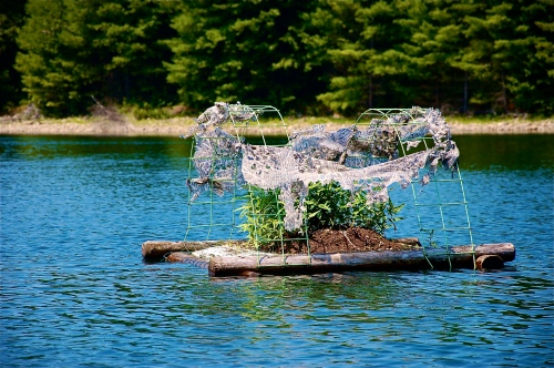
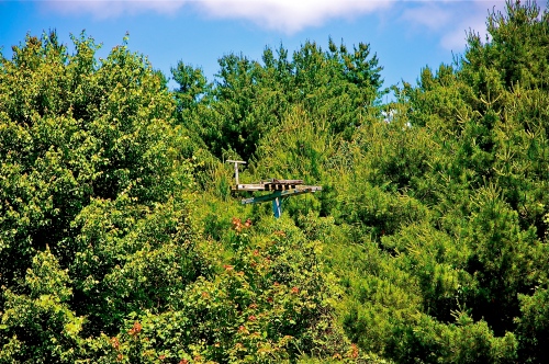
You will see these refuges scattered throughout the north Quabbin
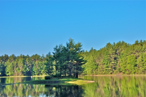
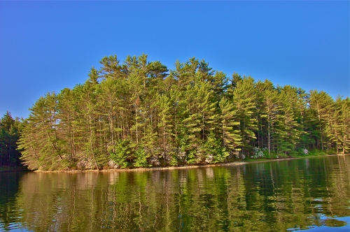
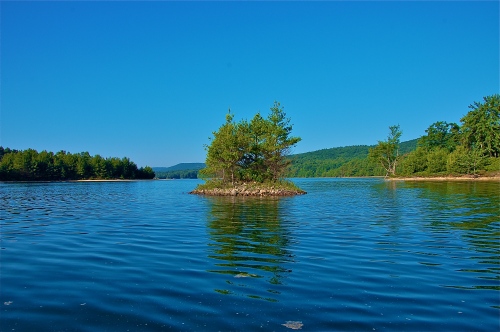
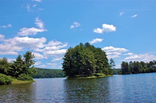
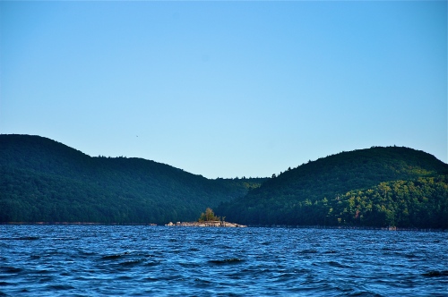
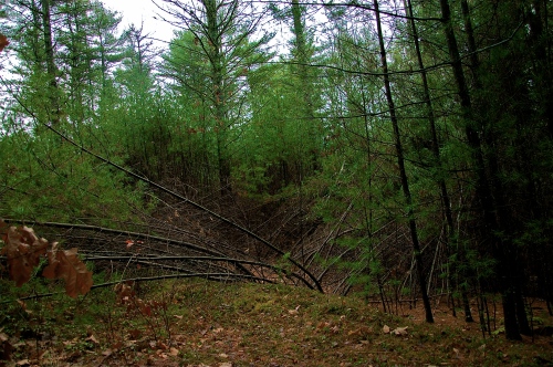
There are innumerable islands like this one in Quabbin
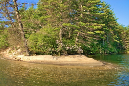
An outcropping of Mountain Laurels
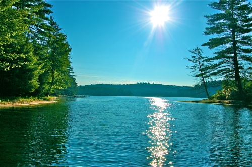
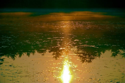
Standard reflection of sunshine in the Quabbin
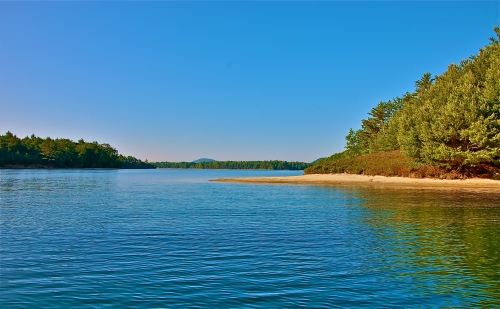
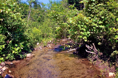
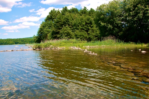
A picturesque view of a sandbar not far from Mountain Laurel Peninsula
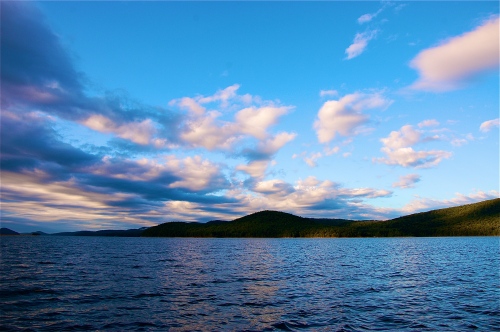
Looking north, with Gays Hill on the horizon
Located on the south end of Pittman Hill, this inlet resembles a Venetian driveway
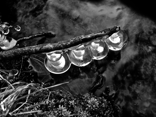
This little beauty is no more than 10′ in diameter
Bald Eagle near Pittman Hill, over the New Salem Watershed
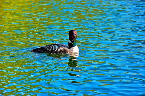
An angry mama-loon yells at me to get away from her baby
Shown here, you can see the loon-ling with mom and dad
An open ley at the base of Rattlesnake North
Where the road at Gate 29 ends
A far out shot of the road to Gate 29, situated to the left of the Rattlesnake North ley
Looking south out of Pittman Hill’s bay
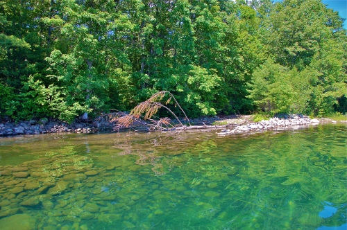
Heading toward Prescott Peninsula, a small island skirts not far from the shore
The inverse of the last photo, looking north
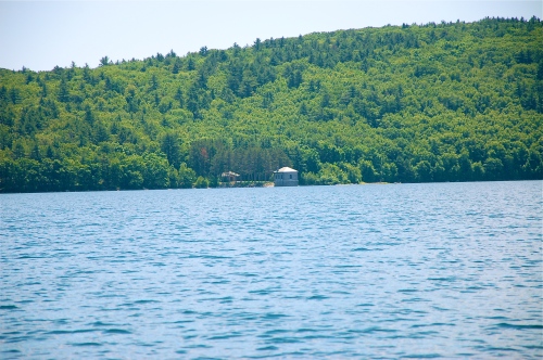
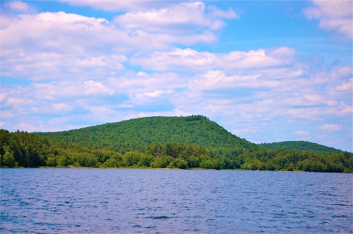
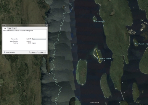
Pictures like this have become a staple of the Quabbin Reservoir. The first major island you see when coming from the north.
Mt L (left) & Mt Russ (right) break to allow passage through the channel in between
If moving toward Mt Russ, you have access through its backside via this strait
A beautiful reflection of a beautiful Quabbin island
A rocky embankment casts itself in front of the view of where Mt Russ meets Prescott Peninsula
This utility pole marks the location of the mouth of Egypt Brook on Prescott Peninsula
The mouth of Egypt Brook
This is the prominent road, just south of Egypt Brook, that shows a dangerous drop off.
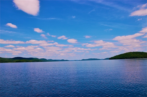
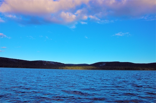
A sunny day, looking north from the open waters.
Buildings used to facilitate direction and flow of water through the aqueduct
With Mt L to the left (north) and Mt Zion right (south), welcome to, “The Pass.”
A bald spot on Mt L as you swing past its south side
Old property boundaries on the north end of Mt Zion
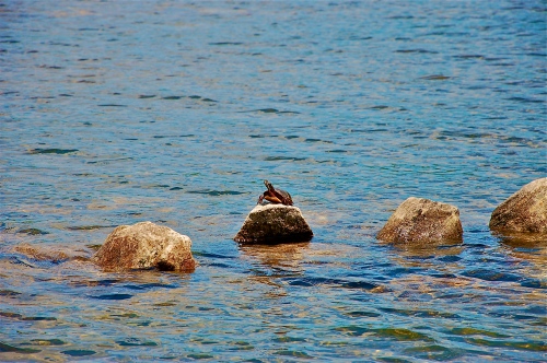
A sunbathing turtle on an old rock wall boundary
Look closely at the rocky wall…..Baffle Dam
Northeast corner of Mt Zion
Left and center of this picture, at the sloping hill in the distance, is the peak of Soapstone Hill
Another angle of Soapstone
At the base of Soapstone, this wall acts as a wall for the water. Formerly a bridge through Dana
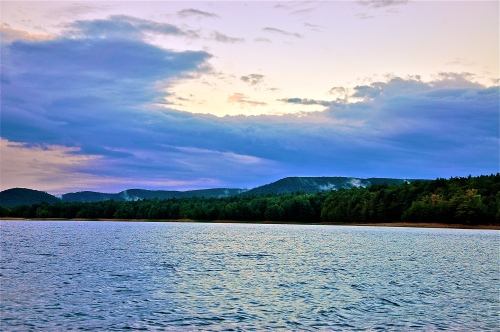
Sunrise over Quabbin creates “smoke signals” of fog
Sunrise creates a bronze sky with more pillars of fog
Sunrise over Mt L & Mt Russ
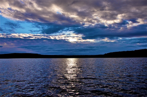
Sunrise casts a bronze color over the water
Light dawns on select portions of the Quabbin
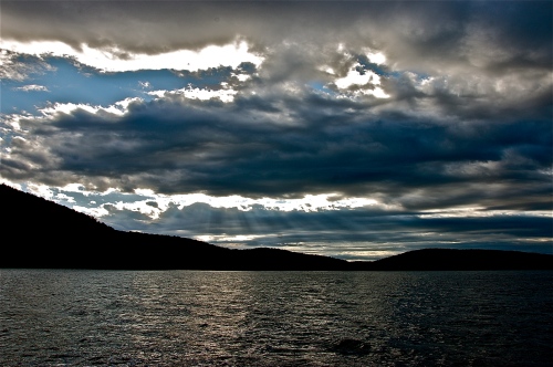
Sun rays burst through the clouds
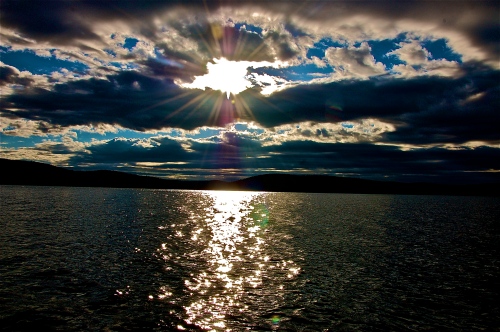
A large ball of fire struggles to get through cloud cover, blurring the edges
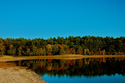
An image of Mt Pomeroy blasts the Quabbin with its wide array of colors
Another, wide angle of Mt Russ meeting Prescott Peninsula
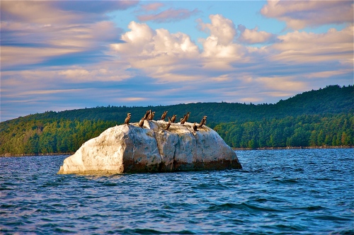
Birds prep for flight off a large stone island
The infamous Dugmar Clubhouse
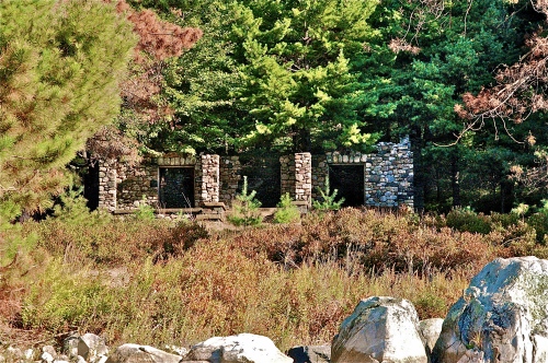
Dugmar Clubhouse on Curtis Hill
Another Bald Eagle
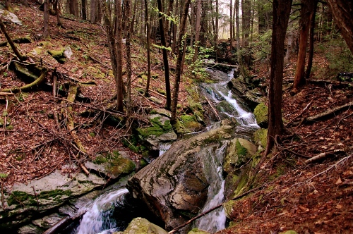
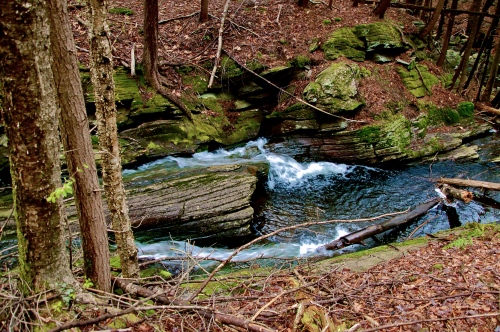
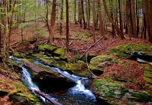
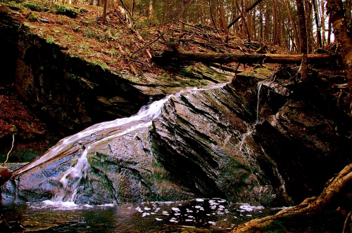
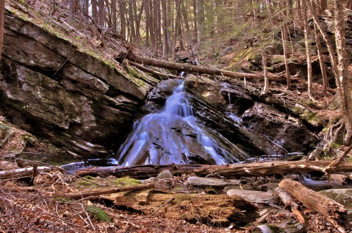
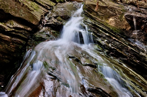
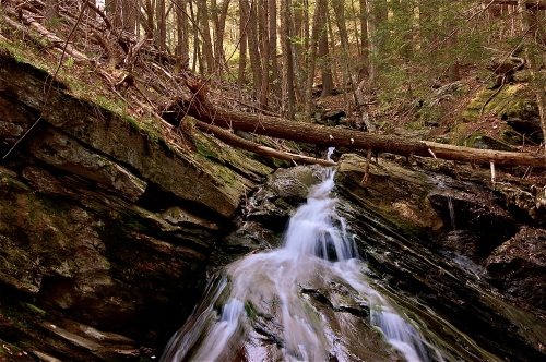
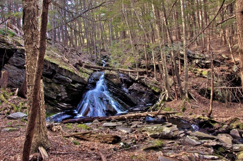
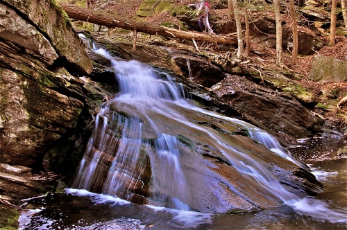
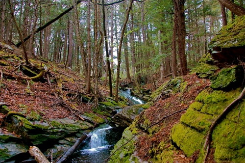
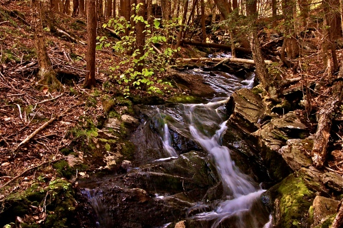
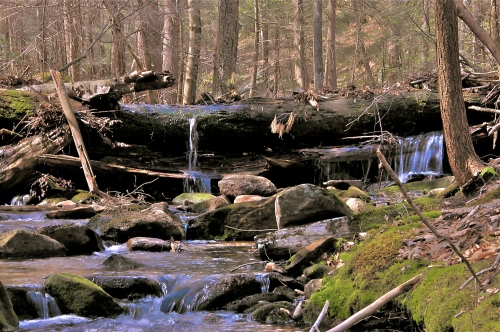
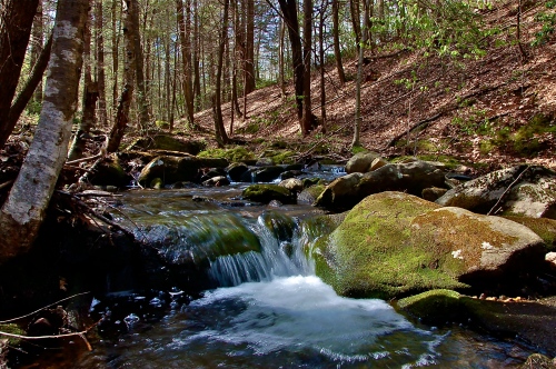
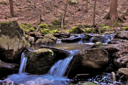
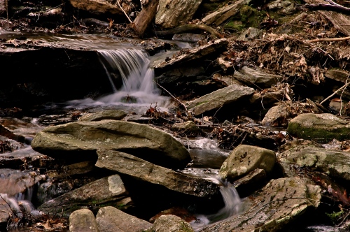
The mouth of Hop Brook in New Salem’s Watershed
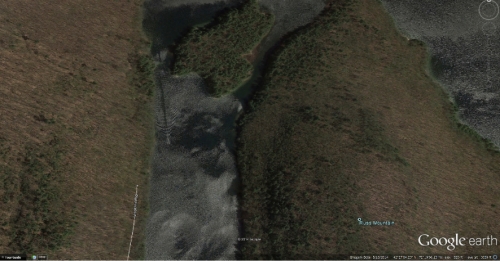
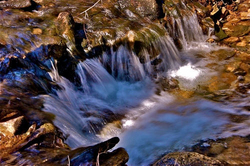
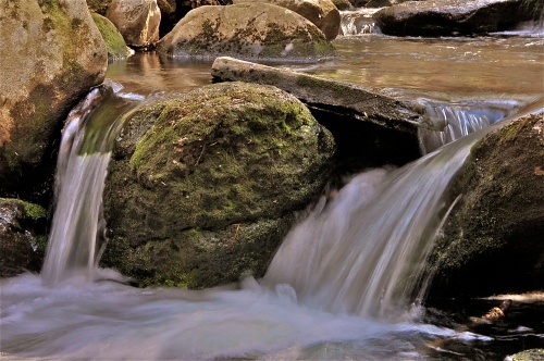
Walking in to Hop Brook’s last waterfall before the mouth empties into the Quabbin.
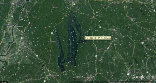

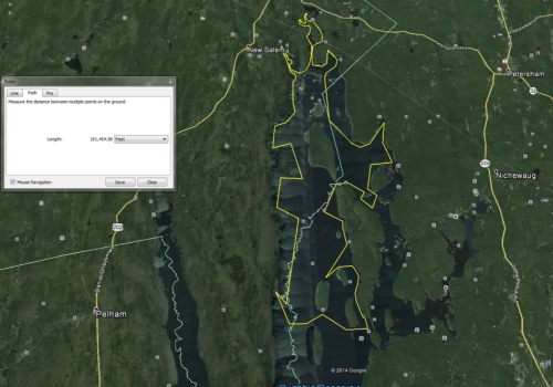
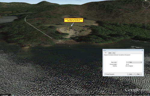
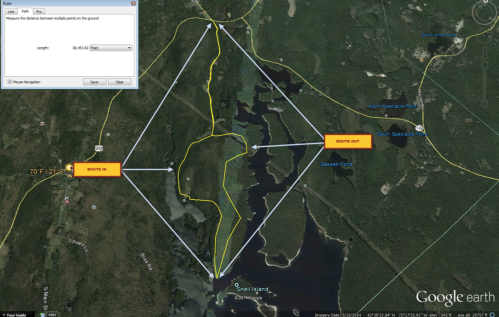
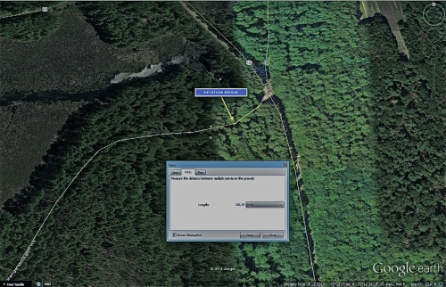
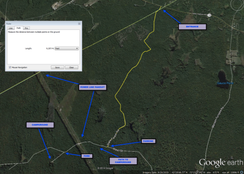
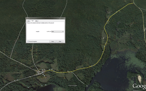
Route taken from the boat launch at Gate 31. Total distance traveled that day, 291,454.98 feet.

Looking closely, you can see Google Earth caught a glimpse of a boat zipping through the strait between Mt. Russ and Prescott Peninsula.
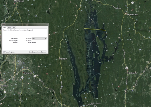
Widest stretch of interrupted water at 28,157.44 feet.
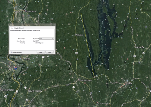
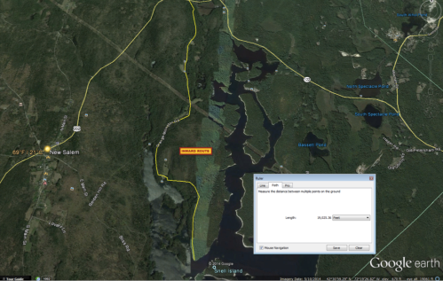
Length of the West Finger measuring 61,657.79 feet.
Distance

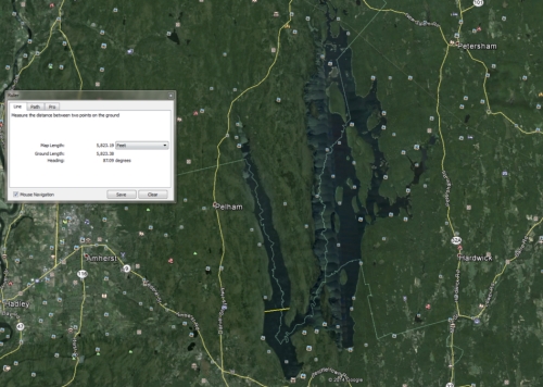
Widest stretch of the West Finger measuring 5,823.29 feet.

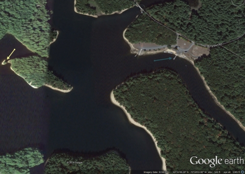
Yellow arrow indicates Angel Island. Green arrow indicates boat launch.


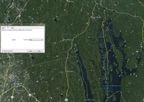
Length of passable water measuring 51,844.92 feet from north to south.

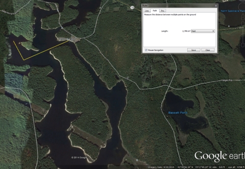
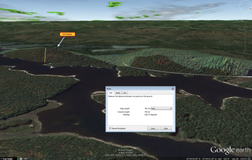
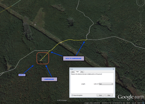
Length of 2,799.67 feet from boat launch to northernmost alcove.
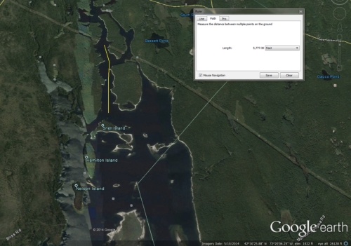
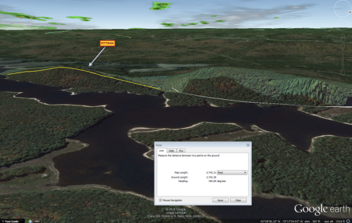
5,772.3 feet from power lines to open waters.


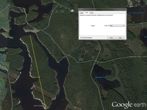
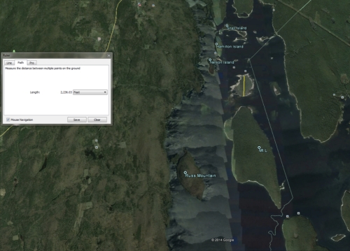
Length of Bassett Island measuring 4,308.79 feet.


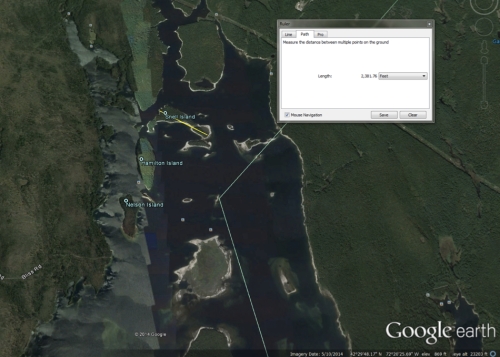
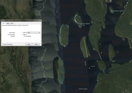
Snell Island total length measuring 2,381.76 feet.

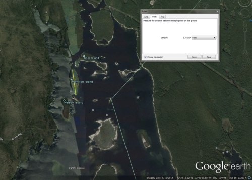
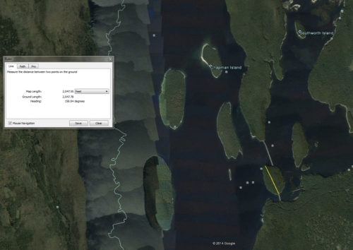
Hamilton Island measuring a total length of 2,351.04 feet.

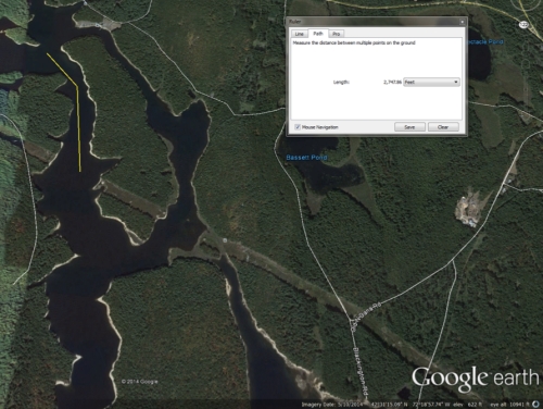
Nelson Island measuring a total length of 1,809.88 feet.


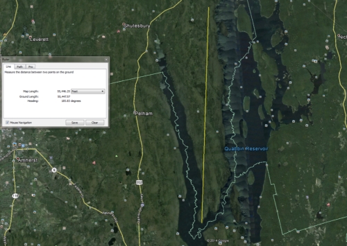
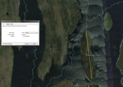
Prescott Peninsula measure a total length of 55,446.25 feet.

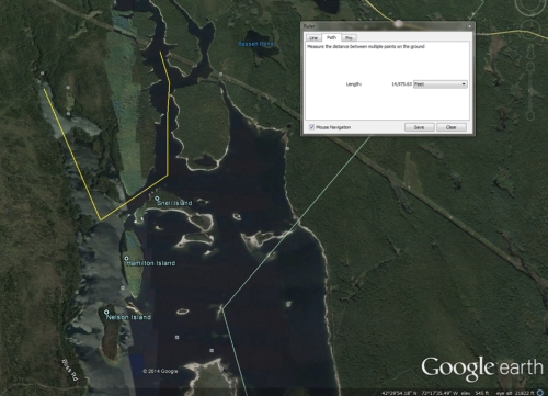
Mt. L measuring a total length of 9,709.29 feet.

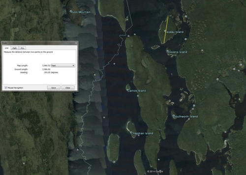
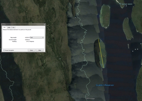
Leveau Island measuring a total length of 3,966.52 feet.

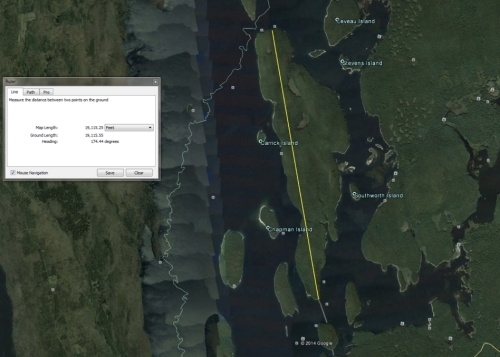
Mt. Zion, the largest island in the reservoir, measures a mighty length of 29,115.25 feet.
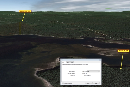
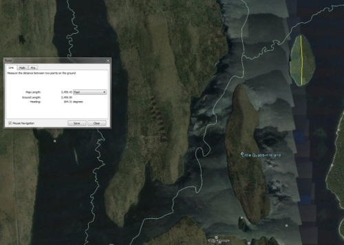
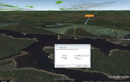
Ground distance of the length of Soapstone Hill’s peak to the water, measured at 1,709.29 feet.
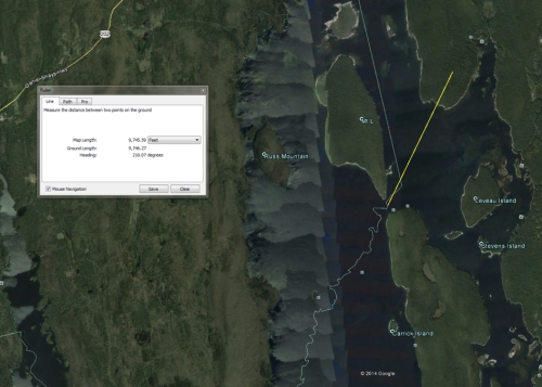
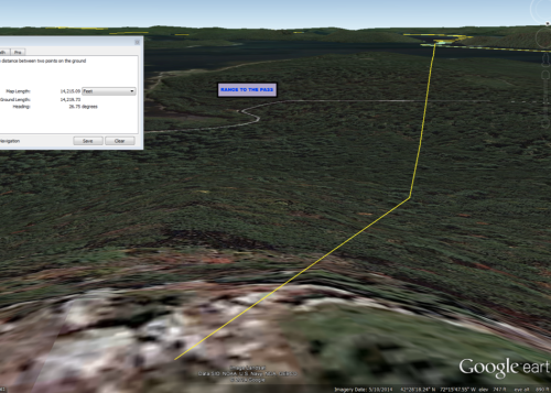
Distance between the peak of Soapstone Hill and The Pass measured at 9,746.27 feet.
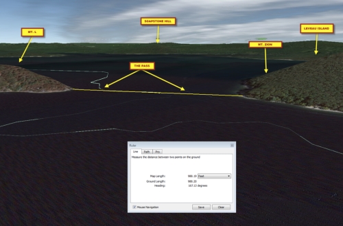
Width of The Pass measuring at 988.2 feet.


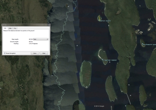
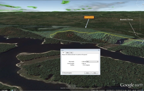
Measuring 177.05 feet from the water’s edge to Dugmar’s Clubhouse on Curtis Hill Island.
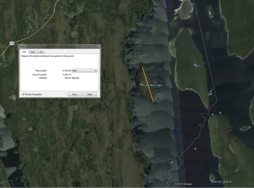
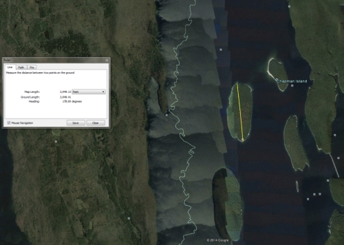
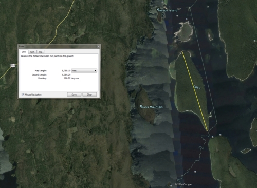
Length of Mt. Russ measuring 4,346.74 feet.


![Past the parking lot, Gate 54A is [fork] left and Quabbin Hill Road is [fork] right](https://quabbinvalley.files.wordpress.com/2014/10/screen-shot-2014-09-27-at-11-51-47-am.png?w=162&resize=162%2C162&h=162#038;h=162&crop=1 "Screen shot 2014-09-27 at 11.51.47 AM")


![Shown here, the white line above the "9" is the road leading in. Upper-center of map shows location of Enfield Tower. Winsor Dam [labeled] to the left side of image](https://quabbinvalley.files.wordpress.com/2014/10/screen-shot-2014-09-27-at-12-02-44-pm.png?w=162&resize=162%2C162&h=162#038;h=162&crop=1 "Screen shot 2014-09-27 at 12.02.44 PM")